EAST TENNESSEE GEOLOGICAL SOCIETY
March 2024 In-Person/Virtual Meeting
Monday,
March 11, 2024
6:00 - 7:30 pm
For those attending in-person
this meeting will be held at the
following location:
Pellissippi State
Community College
Ned R. McWherter Technology Building, Room 126
Note: ETGS members participating virtually will receive an email with info for attending/logging into the meeting.
March 2024 Presentation
Geologic mapping, whole rock geochemistry, and U-Pb zircon geochronology for
terrane characterization and source-to-sink critical mineral framework studies,
southeastern Virginia and northeastern North Carolina
By
Mark Carter, PG, CPG, USGS Florence Bascom Geoscience Center
Abstract
Geologic mapping staff and
students from the U.S. Geological Survey (USGS), Virginia and North
Carolina state geological surveys, and the University of North
Carolina Wilmington, are collaboratively collecting bedrock and
surficial data in the eastern Piedmont and uppermost coastal plain
of southeastern Virginia and northeastern North Carolina. Leveraging
USGS National Cooperative Geologic Mapping Program FEDMAP, STATEMAP
and EDMAP components, and USGS Earth Mapping Resources Initiative
(Earth MRI) resources, the primary goals of this work are to: 1)
construct a seamless geologic map across the Virginia-North Carolina
State Boundary for the USGS National Geologic Map Synthesis; 2)
define and characterize accreted terranes in the easternmost
Piedmont; and 3) combine our new bedrock framework studies with
concurrent stratigraphic and mineralogic analyses of critical heavy
mineral deposits in the adjacent uppermost Atlantic Coastal Plain to
evaluate existing or develop new source-to-sink models.
Prior to this work, the best available published mapping in this
data-poor region included 1:500,000-scale geologic maps of Virginia
and North Carolina, which do not edge match along the state line,
and several outdated small-scale regional compilations. We augment
detailed and reconnaissance bedrock mapping with high-resolution
airborne magnetic and radiometric data acquired by Earth MRI,
whole-rock geochemical analyses, and sensitive high-resolution ion
microprobe-reverse geometry (SHRIMP-RG) and laser
ablation-inductively coupled plasma-mass spectrometry (LA-ICP-MS) U-Pb
zircon geochronology for primary and detrital zircons of mapped
units. In the uppermost coastal plain, our team recently collected
core from an unmined part of the Old Hickory heavy mineral sand
deposit near Cherry Hill, Dinwiddie County, Virginia to define and
date the stratigraphy using cosmogenic nuclides, characterize
sedimentary facies and mineralogy of the deposit, and determine its
provenance using detrital zircon geochronology.
Biography
Mark W. Carter has been a professional geologist since 1996. Mark's expertise is geologic mapping throughout the southern Appalachian crystalline core. He has produced geologic maps and reports in three states (Tennessee, North Carolina, and Virginia) and from four geologic provinces (Valley and Ridge, Blue Ridge, Piedmont, Coastal Plain). As a USGS Research Geologist, he is currently co-project chief of the National Cooperative Geologic Mapping Program Piedmont and Blue Ridge Project. Mark is mapping in southeastern Virginia for critical mineral framework studies, and in northwestern North Carolina for earthquake hazards.
![]()
Greetings, and welcome to the March 11, 2024 ETGS hybrid meeting.
If you attend via Zoom as a courtesy please mute your cell phone or the microphone in your laptop/tablet to minimize background noise and feedback echos. We will also make an effort to mute all participants - at least until the presentation is finished. Please use the chat feature to type any comments or questions you may have. We recommend that you send questions for the speaker to "everyone" so all participants can see the question. In the interest of time, we may hold the Q&A at the end of the presentation.
We will create an in-person and virtual attendance list. It is not always possible
to tell who is participating on-line, especially for those joining by phone,
so please email
etgs@etgs.us
to be listed on the attendance sheet. Let us know exactly how your
name should appear on the list. We will add a note explaining the
lack of signatures due to remote participation and have an ETGS officer sign as usual.
Thank you for your patience and understanding as we try this online
format. As always, we welcome and appreciate your feedback and
suggestions for improvement.
ETGS News:
-
New ETGS mugs are available! If you would like to purchase a mug, email etgs@etgs.us and include "ETGS Mug" in the subject line.
|
|
ETGS Coffee & Beer Mugs... |
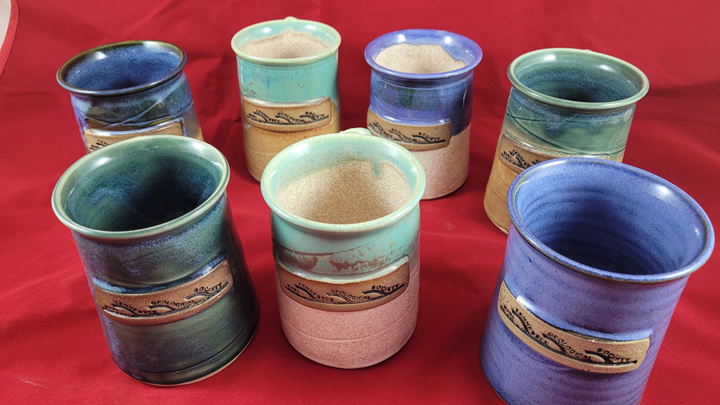 |
We look forward to seeing you at the next meeting.
ETGS is a volunteer organization. We need your help to
continue serving those interested in the geology of East
Tennessee and beyond. Please email us at
etgs@etgs.us
if you would consider assisting in one of the following open
positions. It is a great opportunity to expand your personal
and professional network
President
Tony McClain
Vice
President
David Carlone
Secretary
J.
Brad Stephenson
Treasurer
Seaira Stephenson
Webmaster/Social Media Coordinator
Bob
Gelinas
Page updated April 01, 2024 |